WEATHER WARNING: Northumberland braced for icy blast


The Met Office has placed a yellow Be Aware warning for high winds tomorrow (Wednesday) and snow on Thursday and Friday.
Tomorrow's alert was issued at 9:53am today and is valid from 1am until 11am.
Advertisement
Hide AdAdvertisement
Hide Ad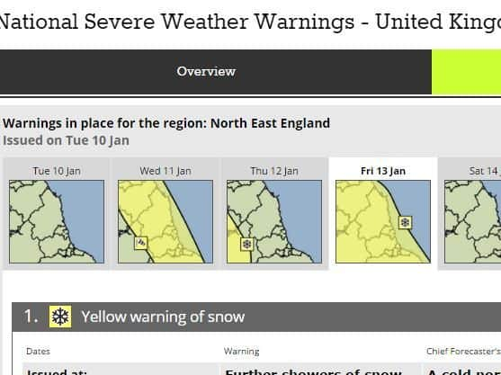
It warned: 'A spell of very windy weather is expected during Wednesday, with the west to northwesterly wind likely to gust 60mph in places, locally 75mph over high ground. Some disruption to road travel is likely, including restrictions on bridges.'
The chief forecaster has added: 'The strongest winds will affect some of the higher level roads, for instance those over the Pennines and the Southern Uplands. However, the northwesterly winds will also be very strong and gusty at lower levels too, including in areas to the east of high ground."
The yellow warning of snow extends from noon on Thursday to noon on Friday.
It said: 'Cold northerly winds will bring occasional snow showers through Thursday and into Friday. Be aware of the potential for disruption to transport networks.'
Advertisement
Hide AdAdvertisement
Hide AdThe chief forecaster added: 'A cold airstream will be in place by Thursday afternoon, bringing occasional snow showers. 2-5cm of snow is possible, with 10cm possible above about 300m.'
1.30pm UPDATE: The warning of snow on Thursday has now been lifted but there is a more widespread prediction of snow on Friday: 'Further showers of snow, sleet and hail will continue across parts of the UK. 2 to 4cm of snow may affect some lowland areas, while high ground may see locally 5 to 10cm. Disruption to transport networks seems likely either due to snow or ice. Additionally, strong winds and large waves will affect some eastern coastal areas.'